
REGISTRATION
Contributions will be published in ISPRS Archives/Annals which are listed in the ISI Conference Proceedings Citation Index (CPCI) of the Web of Science, SCOPUS, the E/I Compendex, and the Directory of Open Access Journals (DOAJ).
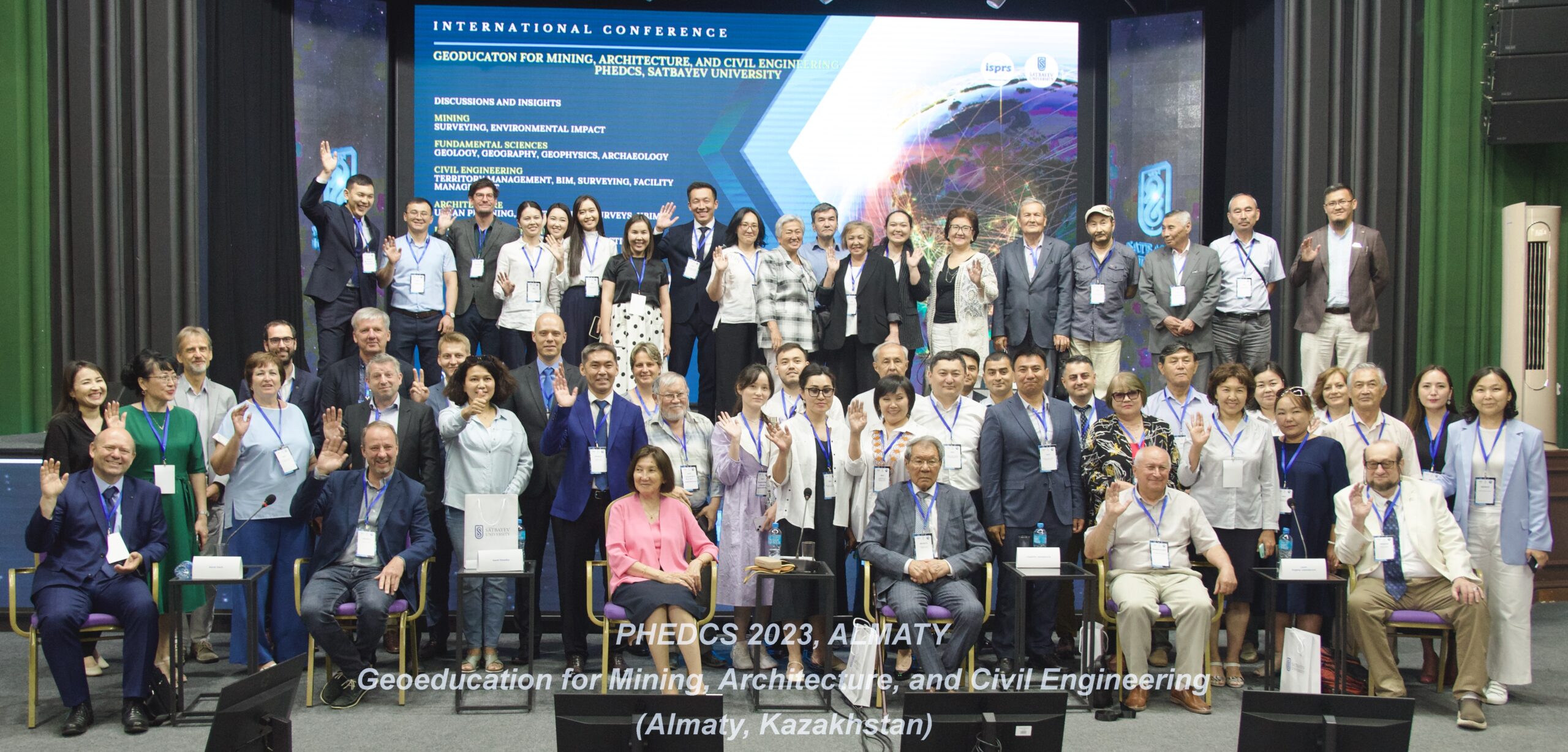
International conference Applied Photogrammetry and Remote Sensing for Environmental and Industry „APRSEI – PHEDCS 2025, TASHKENT“
The international conference is organized by ISPRS Technical Commission WG V/6 and will take place on 23-25 September 2025 at Tashkent State Technical University named after Islam Karimov, Tashkent, Uzbekistan.
CONFERENCE OBJECTIVE
The conference intends to bring together scientists and entrepreneurs from various branches related to geospatial knowledge. The primary goal is focused on the most efficient ways to integrate professionally and crowdsourced geospatial data into civil, architectural, and environmental engineering. To meet this challenge, we are planning to hold several scientific sessions and the ISPRS WG V/6 Workshop. Special attention will be given to the close-range photogrammetry, UAS, LiDAR, and open-sourced geospatial technologies suitable for the conference's key directions.
KEY DIRECTIONS
• Civil Engineering (Territory Management, BIM, Surveying, Facility Management)
• Architecture (Urban Planning, Architectural Surveys, HBIM)
• Mining (Surveying, Environmental Impact)
• Environmental Engineering (Environmental Impact of Construction, Geohazards)
• Fundamental Sciences (Geology, Geography, Geophysics, Archaeology)
CONFERENCE TOPICS
1. Innovative geospatial technologies for the environment, civil engineering, architecture, and mining
industry.
2. Remote sensing technologies for environmental studies.
3. Geospatial technologies for facilities management.
4. BIM and Digital Twins for building life cycle support.
5. Real estate management.
6. Smart Cities.
7. Applied photogrammetry.
DATES
Full paper deadline (Annals)
04.07.2025
Abstract deadline (Archives)
04.08.2025
Notification to authors
14.08.2025
Early bird reg. deadline
15.08.2025
Final paper submission
22.08.2025
Regular reg. deadline
22.09.2025
On-site registration
23.09.2025
REGISTRATION FEES
Tashkent State Technical University
and Partners
€150
€150 Before August 15th 2025
€180 After August 15th 2025
PARTICIPATE - CONFTOOL
VENUE
Tashkent State Technical University named after Islam Karimov,
Universitet St 2, Tashkent,
Uzbekistan
Social events:
1. Trip to Samarkand
Uzbekistan tour Tashkent-Samarkand-Tashkent
More details on the following link
2. Walking around the sights of Tashkent
KEYNOTE SPEAKERS
• Geospatial educational initiatives and new programs development
• 20+ years of academic experience and conducting geospatial engineering projects
• Five years of educational experience in online teaching (video lectures, animated presentations,
animated lab, online testing)
• GIS, Remote Sensing, Geodesy, and Photogrammetry expert (design, development, customization,
and delivery of industrial projects)
• Dr. of Science Geodesy, Photogrammetry, and Cartography (Ph.D. plus 2012)
• Ph.D. in Geodesy (2006)
• Certified Photogrammetrist (ASPRS, US)
• Extensive hands-on experience with Remote Sensing (Assessment of Environmental Impact of
Construction), GIS (Environmental Modelling and Analysis in GIS, Cartographic Design and Mapping in
GIS), Applied Geodesy (Engineering and Global Geospatial Monitoring Projects, Geodetic Conduct of
Large Engineering Structures Assembling, TS, GNSS, TLS, InSAR), BIM (Engineering Structures
Assembling), Close-range Photogrammetry, UAV (Innovative Photogrammetry and Remote Sensing
Technologies for Structure Inventory and Certification, Monitoring and Cultural Heritage
Preservation), and Aerial and Satellite Imagery (Geo-referencing, Bundle Adjustment, 3D Surface
Reconstruction, Ortho-rectification, Mapping, Scientific Proposals Development)
RESEARCH INTERESTS
Research and application of remote sensing, UAS, close-range photogrammetry, and terrestrial laser
scanning, BIM; GIS and remote sensing for town-planning, spatial management, and assessment of
the construction impact on the environment; GIS and remote sensing educational and outreach
activity; geospatial monitoring of engineering structures; geodetic support of civil engineering and
assembling works
Regional Self-Regulating Organization of Construction Association of the
Novosibirsk Region (SRO ASONO)
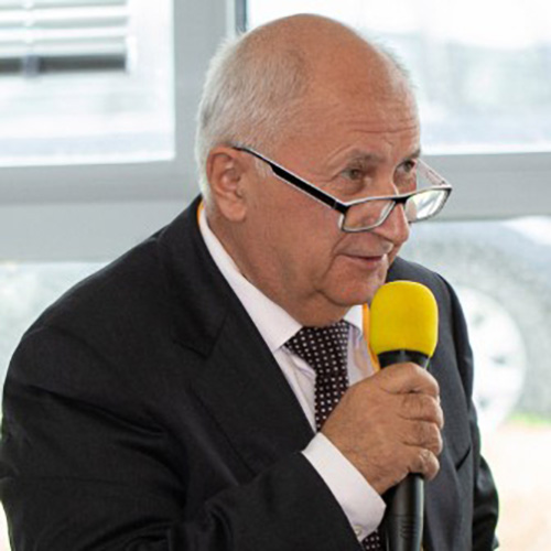
Prof. Vladimir Seredovich, Ph.D. in Applied Geodesy. More than 40 years of educational
experience, scientific and research works, and implementation of new education specialties
such as mine surveying, information systems, cadastre, metrology and new scientific
disciplines: GLONASS, geodynamic polygons, laser scanning, 3D modeling, and
metrological supervision. He founded a new scientific school on laser scanning at the
Siberian State University of Geosystems and Technology in Novosibirsk.
He was a chair of ISPRS WG V/7: Innovative Technologies in Training Civil Engineer and
Architects and main trends of his interest were:
• Innovative geospatial technologies in civil, town planning and architecture
• DEM for construction design
• Building information modeling (BIM) and 3D city models
• Environmental impact assessment
• Geospatial technology for smart city design and planning
• Geospatial technology for structure inventory and certification.
As a scientific supervisor, he was engaged in the implementation of innovative projects in
oil, gas, and mining companies, supervised the deformation monitoring at the Ignalina NPP,
etc.
Since 2016 he has been actively engaged in the following R&D: geospatial solutions for
construction, implementation of BIM and laser scanning technologies, digitalization in the
construction industry, use of UAVs for problem solving in architecture, GIS, ecology, etc. He
is busy at the Regional Self-Regulating Organization of Construction Association of the
Novosibirsk Region (SRO ASONO) with the implementation of digital transformation
technologies in the construction industry, practical implementation of laser scanning
technology at all stages of the object life-cycle.

Prof. Ing. Karel Pavelka, CSc., graduated in 1979 from the Faculty of Civil Engineering of the Czech Technical University in Prague (CTU), majoring in geodesy and cartography. After graduation, he worked at the Department of Photogrammetry at the Research Institute of Geodesy, Topography and Cartography (VÚGTK) in Zdiby. He participated in many photogrammetric projects in Czechoslovakia and abroad (e.g., Iraq, Syria). Since 1992, he has worked at the Faculty of Civil Engineering of CTU in Prague, initially at the Department of Mapping and Cartography, and since 2001 at the Department of Geomatics, where he is the Head of the Department.
He specializes in photogrammetry, remote sensing, and applications of these technologies in cultural heritage documentation and archaeology. He leads and participates in many projects in this field. He is the author or co-author of more than 300 publications and several monographs. He has been involved in projects in Syria, Peru, Iraq, Mongolia, Vietnam, and others.
He specializes in photogrammetry, remote sensing, and applications of these technologies in cultural heritage documentation and archaeology. He leads and participates in many projects in this field. He is the author or co-author of more than 300 publications and several monographs. He has been involved in projects in Syria, Peru, Iraq, Mongolia, Vietnam, and others.
Research topics
Spatial documentation of historical objects using geomatics methods
-mobile and static laser scanning
-photogrammetry
-geophysical methods
Data visualization using VR/AR
Remote sensing
Astronomy
Currently implemented projects
AMUSED (international project, EU, virtual museums), 2023-2025
Ministry of Education Research infrastructures for educational purposes 2023, CZ.02.1.01/0.0/0.0/16_017/0002390
Completed projects
-“Global Student Village” satellite data receiving station, 1993-1997, ERIM (USA), CTU Prague
-Corine Land coverí, MARS project, ISPRA Italy, 1995-1999
-Photogrammetric documentation of the Great Umayyad Mosque in Aleppo (Syria), UNESCO, 1999-2000
-Documentation of geoglyphs and petroglyphs in the Nasca region, Peru, Cooperation with HTW Dresden (international project), 2004-2016, digital photogrammetry and remote sensing
-Comprehensive documentation of the Charles Bridge in Prague by digital photogrammetry and laser scanning (2004-2006)
-Documentation of historical objects in Iraqi Kurdistan; Al-Qala citadel in Erbil/Iraq using photogrammetry, remote sensing and GIS technology, GemaArt+ČVUT in Prague (2006-9), photogrammetric documentation of the Choli minaret in Erbil and the Dalal bridge in Zakho, documentation of the old Quba-han madrasa in Amedi (2010), 3D documentation of the geophysical research of the shrine of the prophet Nahum in Alqoshi (2018), documentation of the caravanserai in Koya and the old synagogue in Shushi (2021–2022)
-Documentation of baroque sculptures in Kuks (2007), baroque vaults in Rome and Prague (2010-17) using laser scanning and photogrammetry
-Documentation of historical subsurface areas at Košumberk Castle and Dobřík Fortress using laser scanning (2007, 2008), archaeological sites in the Czech Republic (2010-2018)
-Geophysical survey archaeological and historical sites with georadar and walkable magnetometer (e.g. Panenský Týnec, Teplá, Strakonice, Charles Bridge in Prague, relics from the Thirty Years' War, etc. 2009-2017)
-Documentation of Jewish architecture using photogrammetry and laser scanning in Morocco (2021)
-Long-term plan: 3D scanning and printing, remote sensing, aerial photogrammetry and ALS, geophysical techniques as an aid for non-destructive documentation in architecture and archaeology, use of hyperspectral mapping and UAV for documentation of historical objects and thematic mapping, member of the international expedition to Greenland (2015, 2019), Kurdistan and Peru (2004-2018)
-Director of the 23rd CIPA Symposium in Prague 2011 (219 participants from 30 countries)
-2018-2021: grant from the Ministry of Education, Youth and Sports, modernization of the doctoral study program geodesy and cartography (ESF+ERDF)
-2019-20 grant of the Ministry of Education, Youth and Sports, modernization, computerization and remote access to the astronomical observatory of the Faculty of Engineering of the Czech Technical University (ERDF)
Membership
ISPRS International Society for Photogrammetry and Remote Sensing
SFDP Czech Society for Photogrammetry and Remote Sensing
CIPA International Committee of Architectural Photogrammetry
ICA International Cartographic Association
Science profile
https://www.researchgate.net/profile/Karel-Pavelka/2
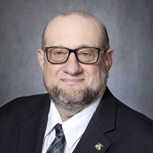
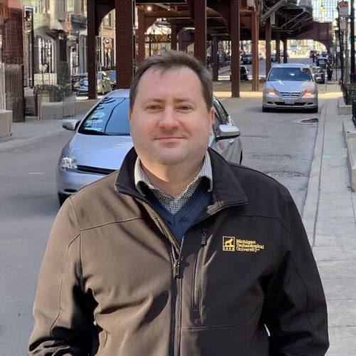
Eugene Levin, Ph.D., ASPRS Certified Photogrammetrist, is an expert in geospatial science
and technology with over 35 years of academic and industry experience. His expertise spans
photogrammetry, GIS, WebGIS, mapping, remote sensing, cartography, VR/AR/MR, 3D
visualization, human factors, robotics, Lidar, In-SAR, UAV, and aerial/satellite product
development. Dr. Levin has pioneered innovative approaches, including an eye-tracking-based
method for cognitive GIS and geospatial image processing, a 4D-GIS system for robotic
platform navigation, and small UAV platforms, including 3D-printed designs. He has also
developed mobile mapping platforms integrating GPS, Lidar, and imaging sensors.
As a Principal Investigator and Program Manager, Dr. Levin has led award-winning government
programs for the NASA, NGA, US Air Force, Navy, Army, and HSARPA. His collaborative
research extends globally, working with scientists from China, Tanzania ,Germany, Israel, Italy,
Lithuania, Poland, Ukraine, Russia, and Kazakhstan.
Currently, Dr. Levin serves as Professor of Spatial Data Science and Director of International
Programs in the Department of Biomedical Data Science at Meharry Medical College's School of
Applied Computational Sciences. His work focuses on AI and machine learning in spatial data
science, geospatial big data, immersive visualization, and cognitive GIS.
Dr. Levin is an active member of professional organizations, including the American Association
for Geodetic Surveying (AAGS), the American Society for Photogrammetry and Remote
Sensing (ASPRS), and the International Federation of Surveyors (FIG). He also contributes to
ISPRS working groups on innovative technologies in civil engineering and architecture.
PARTNERS


CONTACT US
Tel.: +420 776 592 329
Karel Vach
Email: info@phedcs.com