Online training is a real chance to beef up your knowledge during these tremendous times.
Join us! We are PHEDCS.
If you are interested please contact us:
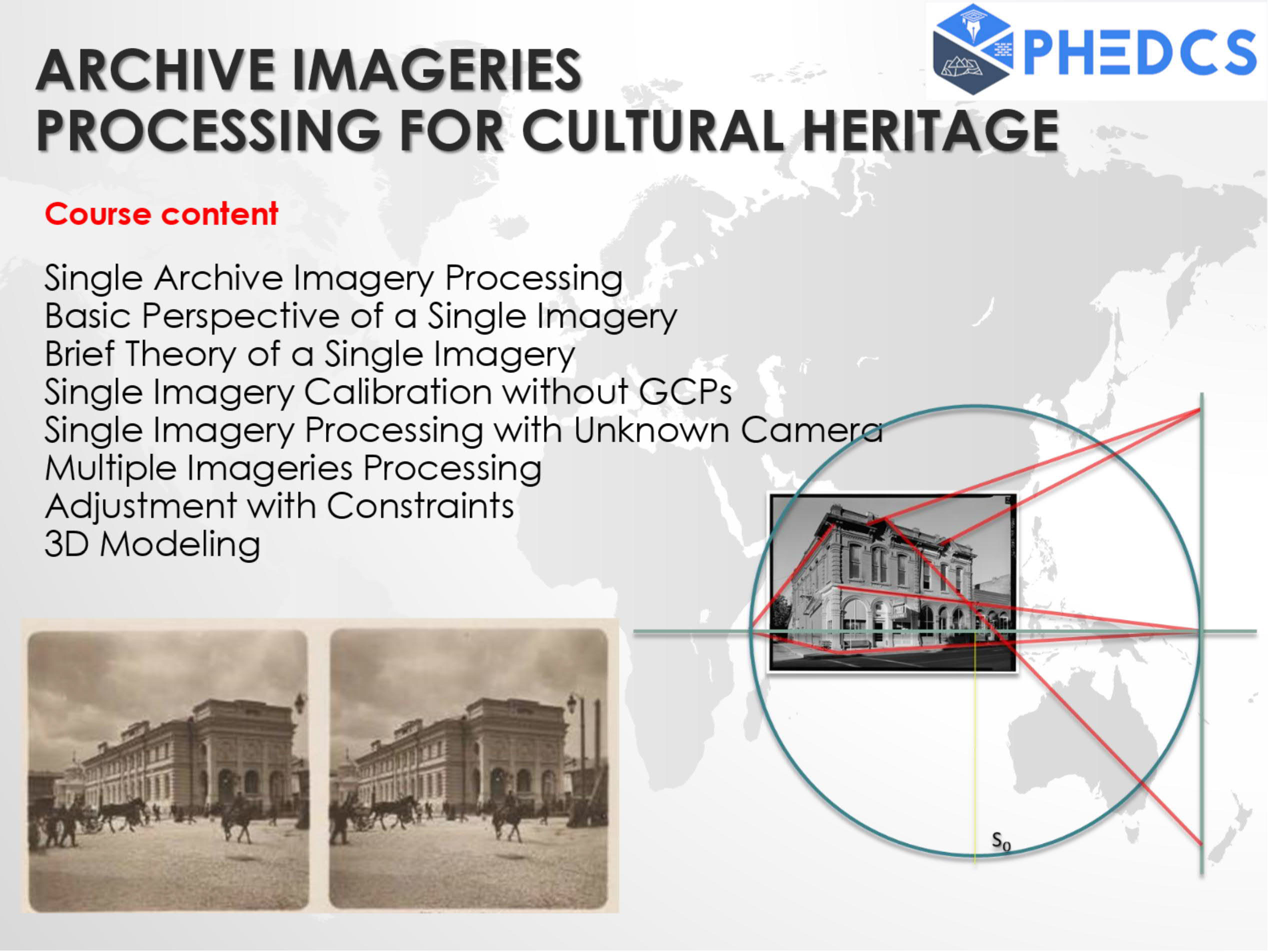
ARCHIVE IMAGIERIES PROCESSING FOR CULTURAL HERITAGE
Course content
- Single Archive Imagery Processing
- Basic Perspective of a Single Imagery
- Brief Theory of a Single Imagery
- Single Imagery Calibration without GCPs
- Single Imagery Processing with Unknown Camera
- Multiple Imageries Processing
- Adjustmenet with Constraints
- 3D Modeling
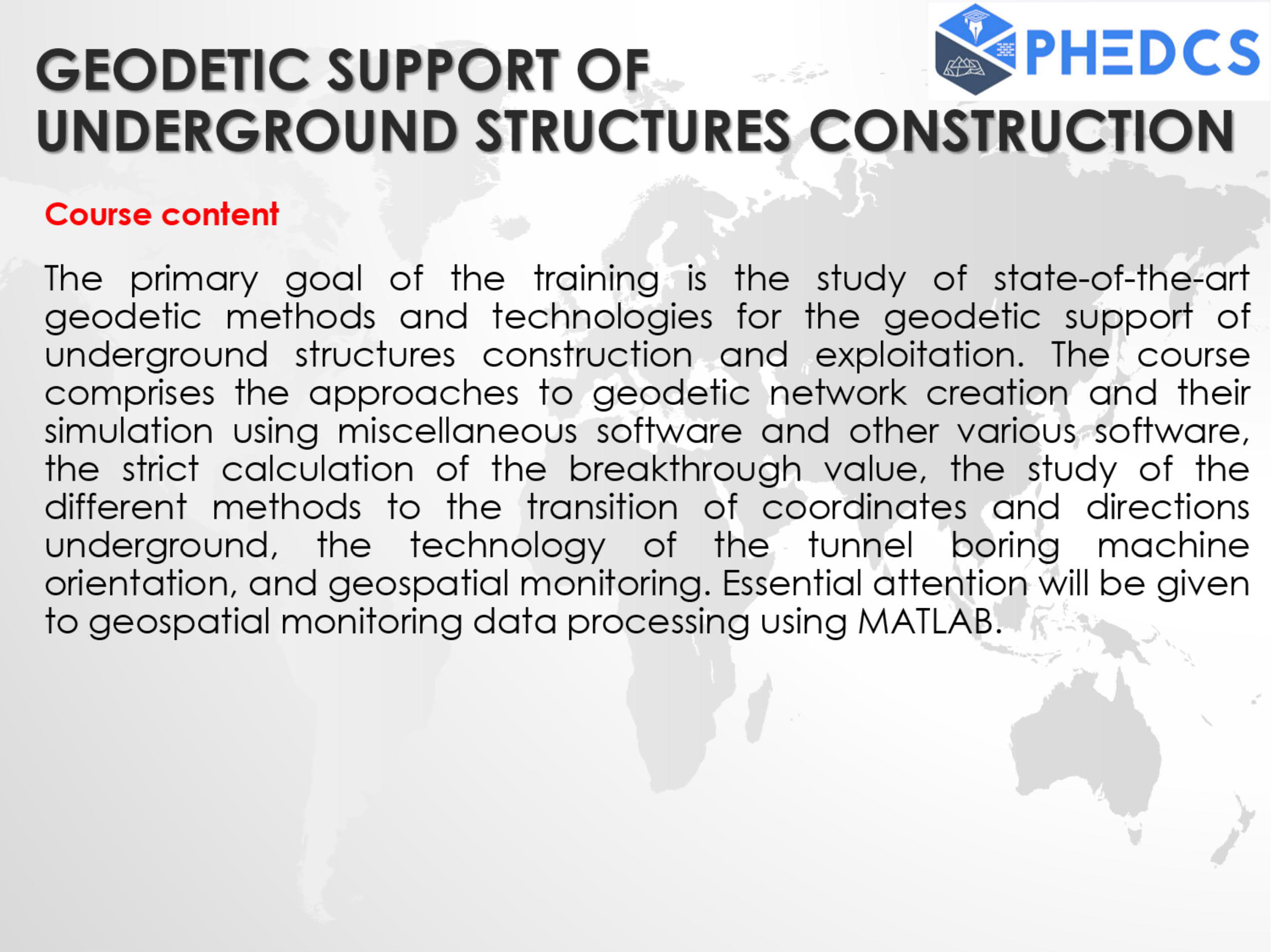
GEODETIC SUPPORT OF UNDERGROUND STRUCTURES CONSTRUCTION
Course content
The primary goal of the training is the study of state-of-the-art geodetic methods and technologies for the geodetic support of underground structures construction and exploitation. The course comprises the approaches to geodetic network creation and their simulation using miscellaneous software and other various software, the strict calculation of the breakthrough value, the study of the different methods to the transition of coordinates and directions underground, the technology of the tunnel boring machine orientation, and geospatial monitoring. Essential attention will be given to geospatial monitoring data processing using MATLAB.
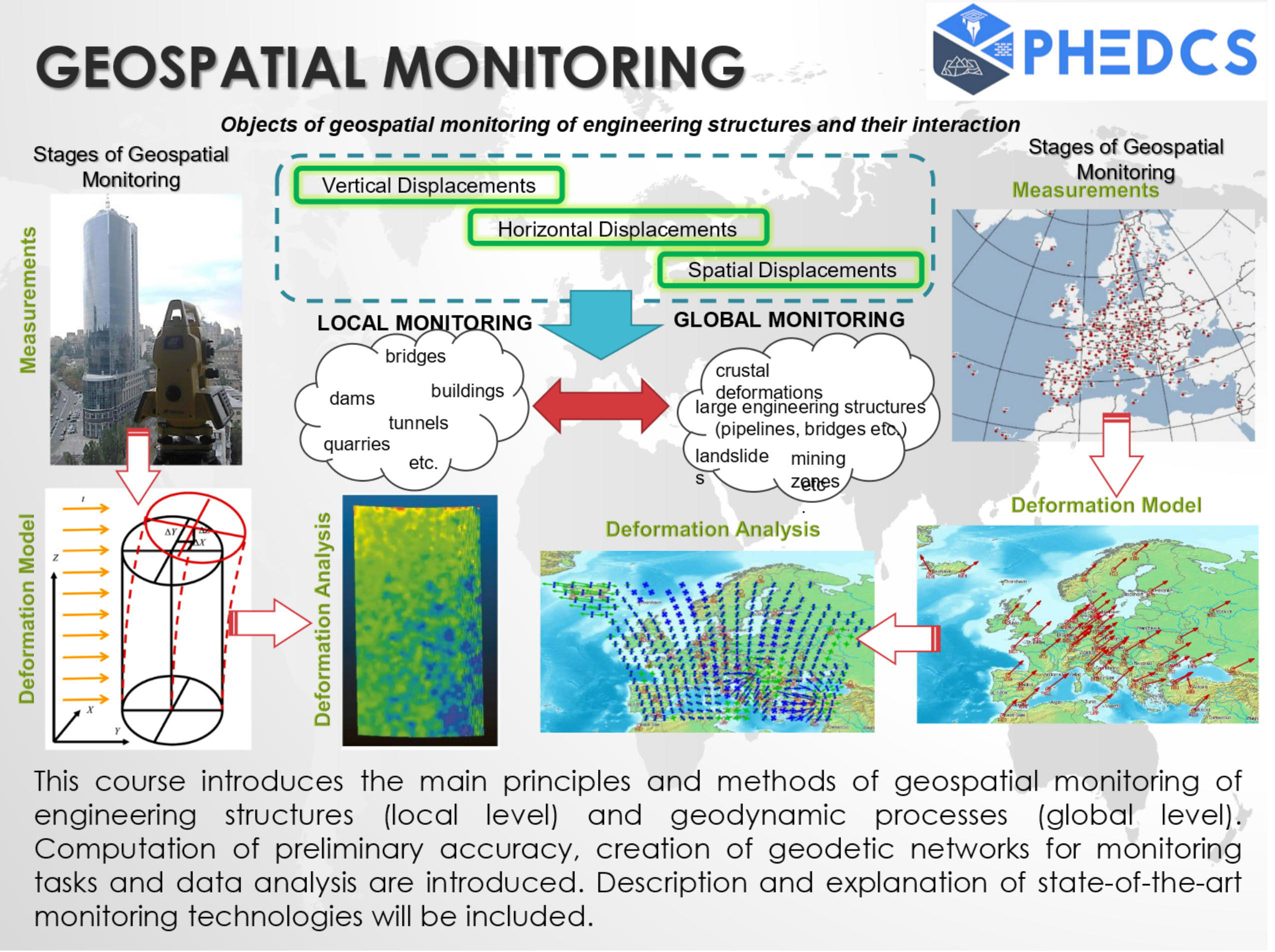
GEOSPATIAL MONITORING
Course content
This course introduces the main principles and methods of geospatial monitoring of engineering structures (local level) and geodynamic processes (global level). Computation of preliminary accuracy, creation of geodetic networks for monitoring tasks and data analysis are introduced. Description and explanation of state-of-the-art monitoring technologies will be included.
MATLAB FOR DATA PROCESSING IN GEOSCIENCES
Course content
The first part of the course is about initiating, planning and organizing a project. It introduces the Internet resources used in the following chapters to search for geoscientific information, as well as the software and online tools used to manage projects, to process data, to exchange information, and to present project results, searching and reviewing scientific literature and data on the Internet, literature resources, extract information from the literature for use within the reader´s own projects, and introduces software for managing large collections of electronic journal articles and books.
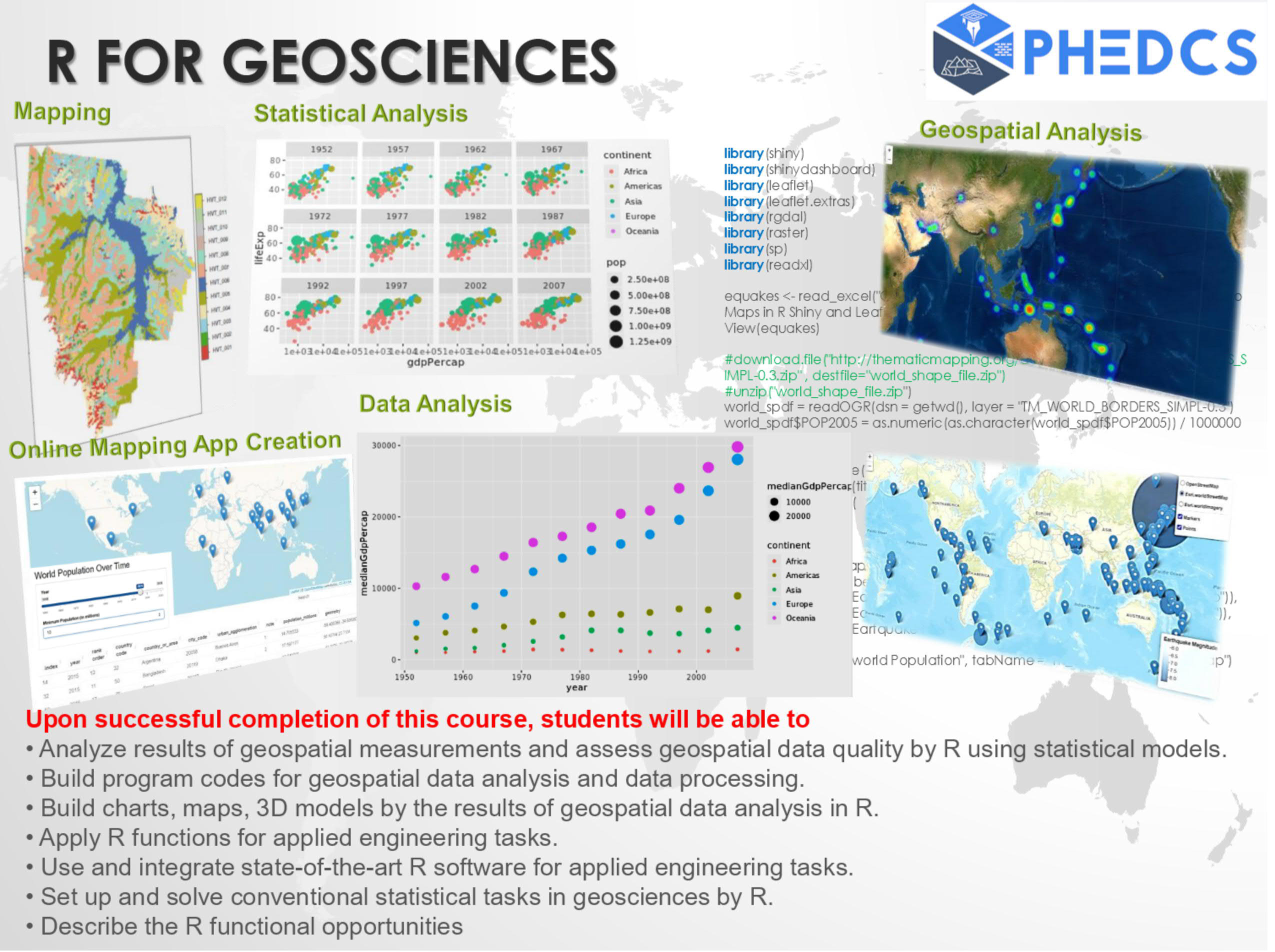
R FOR GEOSCIENCES
Course content
R for Geosciences is intended to build up modern engineers and scientists and to get them acquainted with a powerful tool for the solution of miscellaneous applied statistical tasks in geosciences. The course consists of three parts: it starts from the brief introduction about R. Why Use R? R and statistics. R and plots. The R Graphical User Interface. First steps in R. Then follow basic concepts and data organization, importing, exporting, and producing data. Next chapter considers data manipulation and R, and its documentation. It is paid much attention to drawing curves and plots. The second part comprises programming in R. Developing functions, declaring, creating and calling functions, basic concepts on functions, and object-oriented programming. The third part comprises elementary mathematics and statistics in R. It starts from basic mathematics: matrix operations, integration, optimization and then keeps on with simple and multiple linear regression, fitting data and elementary analysis of variance. Each step of the course accompanies with examples of real data processing from navigation, environmental science, GIS, geodesy and so forth. Students finalize the course by the research project devoted to their research topics.
List of successful participants